Milwaukee River Shuttles – Easy Access to Your Next Paddling Adventure!

Let us handle the logistics so you can focus on the paddling! Forward Outdoor offers kayak and canoe shuttle services along the Milwaukee River and beyond—starting with 10 sections from West Bend to Milwaukee, with more rivers coming soon. Whether you’re using your own boat (must be 16′ or shorter to fit in our trailer) or renting one of our high-quality kayaks, our shuttle service makes it simple to explore the river—without the hassle of arranging transportation.

What is a River Shuttle?

A river shuttle lets you paddle one-way without worrying about how to get back to your car. Here’s how it works:
 Park your car at the take-out (where you’ll finish your trip).
 Hop in our van, and we’ll transport you upriver to the put-in.
Get geared up with either your boat or ours, then we give you an orientation and you’re off!
 Paddle back to your car at your own pace, no need to worry about vehicle logistics!

We run one section per weekend day from spring through fall, offering our four core sections more frequently while ensuring each section is available at least twice per season. Our high-quality rental is a sit-on-top kayak, with options for tandems or sit-insides if available.

Below, you’ll find details on each section we run—choose your adventure, hop on the shuttle, and enjoy the river!

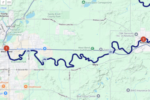
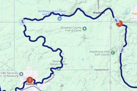
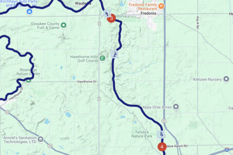
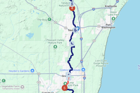
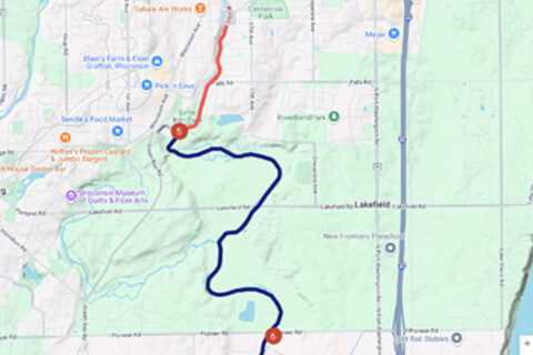
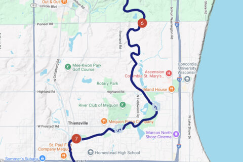
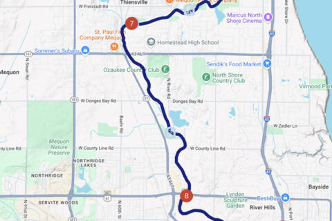
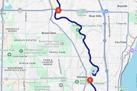
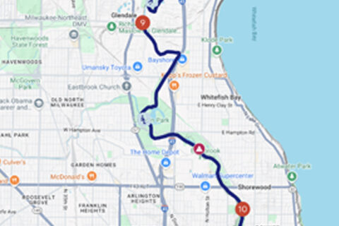
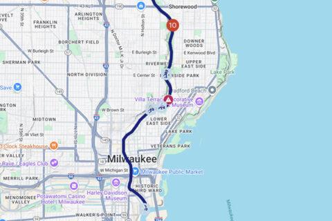
Interactive Paddle Passport Google Map

Explore More Paddling Resources

These resources can help you navigate routes, check water conditions, and discover even more great paddling destinations:

🌊 Milwaukee Urban Water Trail – A guide to paddling the Milwaukee River through the city.
🛶 Wisconsin River Trips – Trip reports and route info for rivers across Wisconsin.
📍 Treasures of Oz – Insights into paddling spots and water trails in Ozaukee County.
📊 USGS Water Gauge – Real-time water level data for the Milwaukee River.

Whether you’re exploring with Forward Outdoor or planning a self-guided trip, these tools will help you make the most of your time on the water! 🚣‍♂️

Section 1: West Bend

Put-In: Hwy 33 Dam
Take-Outs: Riverfront Park, Quass Creek Park, Goeden Park/Hwy M

When we run this shuttle, we will have you park at the end at Fireman’s Park in Newburg. We will start the day with the first shuttle dropping off at the start at Hwy 33 for those that would like to run the full section. Then we will return to Newburg to pick up people that would like to start at Quass Creek Park and run a shorter section.

Section # Section Miles Section Name Put In Take Out River Miles Time (hrs)
1
12.7
West Bend
1a Hwy 33 Dam Quass Creek Park 3.7 2
1b Quass Creek Park Goeden Park/Hwy M 5.9 3
1c Goeden Park/Hwy M Newburg Firemans Park 3.1 1.5

Section 2: Newburg

Put-In: Newburg Fireman’s Park
Take-Outs: Hwy A bridge, Waubedonia Park

This shuttle starts by meeting at Waubedonia Park, then we will shuttle the first group of the day all the way up to Fireman’s Park in Newburg to run the full section. After that we will return to Waubedonia to pick up another group that we will drop at the Hwy A Bridge to run a shorter section, all of which end back at Waubedonia.

Section # Section Miles Section Name Put In Take Out River Miles Time (hrs)
2
11
Newburg
2a Newburg Firemans Park Hwy A 5.8 3
2b Hwy A Waubedonia Park 5.2 2.5

Section 3: Saukville

Put-In: Waubedonia Park
Take-Out: Ehlers Park

This is the first of our “Core 4” sections of the Milwaukee River. We meet at Ehlers Park in Saukville. There are two parking lots (north and south), and you will receive instructions in your pre-departure email on which one to meet at depending on water levels. Then we transport you up to Waubedonia to begin your trip, ending back at Ehlers. There is a small Class I rapid/riffle that is towards the beginning of the trip, but is appropriate for all levels of paddlers. There are some optional stops or take-outs at Hawthorne Hills and Tendick Park.

Section # Section Miles Section Name Put In Take Out River Miles Time (hrs)
3 5 Saukville 3 Waubedonia Park Ehlers Park 5 2

Section 4: Grafton

Put-In: Ehlers Park
Take-Outs: Peninsula Park, Grafton Canoe Launch, Grafton Veteran’s Memorial Park

We meet at Grafton’s Veteran’s Memorial Park, then shuttle up to Ehler’s Park for the full section. Then we return to Veteran’s Park to pick up the next round of paddlers to do a shorter section that starts at Peninsula Park in Saukville.

Section # Section Miles Section Name Put In Take Out River Miles Time (hrs)
4
8
Grafton
4a Ehlers Park Peninsula Park 2.3 1
4b Peninsula Park Grafton Canoe Launch 1.9 1
4c Grafton Canoe Launch Veteran’s Park 3.8 2

Section 5: Mequon

Put-In: Lime Kiln Park in Grafton
Take-Out: Garrison’s Glen in Mequon

This is a shorter section, but one of the most scenic with small “dells” like those found in Wisconsin Dells. The put-in starts right in moving water, so it may be slightly challenging for a first-time or novice paddler. There are some small rapids not too far south of Lime Kiln where the river splits, and can be navigated in either direction.

*NOTE* We do NOT run the RED section upriver from the dam in Grafton to Lime Kiln as it involves some Class II rapids depending on water levels and should only be attempted by those with proper experience, training and gear.

Section # Section Miles Section Name Put In Take Out River Miles Time (hrs)
5 3.3 Mequon 5 Lime Kiln Park Garrison’s Glen 3.3 1.5

Section 6: Thiensville

Put-In: Garrison’s Glen in Mequon
Take-Out: Thiensville Village Park

There is also a well-hidden take-out at Moonlight Landing on river left shortly after the bridge for Highland Road. 100-yard carry to parking access at bend in N Island Dr. There is also the Villa Grove Park takeout shortly before the end at Thiensville Village Park. Villa Grove does have a porta-potty next to the main dock.

Section # Section Miles Section Name Put In Take Out River Miles Time (hrs)
6 6.5 Thiensville 6 Garrison’s Glen Village Park 6.5 2.5


Section 7: Brown Deer

Put-In: Thiensville Village Park
Take-Out: Badger Meter River Park in Brown Deer

Reliable water levels and a good bathroom stop at River Barn Park about two-thirds of the way through make this one a nice member of our Core 4.

Section # Section Miles Section Name Put In Take Out River Miles Time (hrs)
7 4.5 Brown Deer 7 Village Park Badger Meter Park 4.5 2


Section 8: Glendale

Put-In: Badger Meter River Park in Brown Deer
Take-Out: Kletzsch Park in Glendale

A pleasant paddle with some backyards and the Milwaukee Country Club, with plenty of good views.

*NOTE* There is a dam not too far after this takeout (0.4 mi), so make sure to pay attention to this takeout (follow your phone’s map) as there is no signage for the takeout and it is around a corner. If you do go past it and come upon the waterfall there is a portage (get out and go around) on the right (west) as you are paddling.

Section # Section Miles Section Name Put In Take Out River Miles Time (hrs)
8 4.6 Glendale 8 Badger Meter Park Kletzsch Park 4.6 2


Section 9: Shorewood

Put-In: Kletzsch Park in Glendale
Take-Out: Hubbard Park in Shorewood

This section goes through Lincoln Park (optional landing with porta potty), and then past Estabrook Park.

*WARNING*: There is a mandatory portage (get out and go around) at the Estabrook Park waterfall. As you are paddling on the right is a short, convenient take-out and put-in with a short carry/drag. The paddler’s left (east) side of the river has the Estabrook Beer Garden at the top of the hill with beer, food and bathrooms. This carry is quite long and hard to navigate among the trees but is doable for beer garden.

Section # Section Miles Section Name Put In Take Out River Miles Time (hrs)
9 5.4 Shorewood 9 Kletzsch Park Hubbard Park 5.4 2


Section 10

Put-In: Hubbard Park in Shorewood
Take-Out: Bruce Street Ramp in Milwaukee

An exciting end to the river as it connects with the Kinnickinnic and Menomonee Rivers then dumps into Lake Michigan. There is a small drop under the Locust St. bridge, then another drop and a series of rapids at the North Ave bridge. These rapids will get to be Class II in higher water and should be attempted with caution. There are options on both sides of the river to portage (get out and go around) for those not wanting to attempt the rapids. The river opens up and slows down after this as you float through the City of Milwaukee with access to everything downtown life has to offer.

Section # Section Miles Section Name Put In Take Out River Miles Time (hrs)
10
4.8
Milwaukee
10a Hubbard Park Riverside Park 1.1 0.5
10b Riverside Park Kiwanis Landing 0.6 0.25
10c Kiwanis Landing Bruce St Launch 3.1 1.75